Creating Emergency Digital Maps for Flash Flood Zones
You need emergency digital maps that use real-time data from sensors and radar to track flash floods accurately. Build them with local knowledge-residents spot hidden risks like ponding water or weak roads. Choose tools that update every 60 seconds via cloud sync and send alerts when water levels spike. Use high-contrast colors, clear icons, and bold evacuation paths so they’re readable in stress. Outdated maps get people killed; fast, verified updates save lives-what works now is clear, and there’s more to get right.
Notable Insights
- Integrate real-time data from sensors, radar, and river gauges for accurate, up-to-the-minute flood tracking.
- Use early warning systems to alert communities before floodwaters reach dangerous levels via reliable notification channels.
- Incorporate local knowledge to identify flood-prone areas and improve map accuracy, especially in remote regions.
- Ensure rapid map updates using cloud-based platforms that sync changes across devices within seconds during emergencies.
- Design maps with high-contrast colors, clear icons, and bold lines to ensure readability under high-stress, low-visibility conditions.
Why Emergency Maps Save Lives in Flash Floods
How prepared are you when floodwaters rise without warning? Emergency digital maps provide early warnings that give you critical minutes to react. These alerts, sent through reliable systems, notify you before water reaches dangerous levels. You’ll know exactly where to go because the maps include clearly marked evacuation routes, updated for current road conditions. Without them, you risk delays or choosing unsafe paths. In flash floods, seconds matter-routes blocked by standing water or debris can turn deadly. Digital maps use verified data to guide you along viable exits. You don’t need guesswork when the right path is displayed in real time. Even in low signal areas, cached map versions remain accessible. They’re functional, not flashy. Relying on them improves your odds considerably. It’s not about technology for its own sake-it’s about getting you to safety efficiently. For reliable options, consider checking the best emergency maps based on expert testing and real-world performance.
Use Real-Time Data to Map Flood Zones
What if your map already knew where the water’s rising before you did? Real-time data makes that possible. You’re relying on constant updates from weather stations, radar, and river gauges to track flooding as it happens. Sensor integration pulls inputs from multiple sources-rainfall sensors, water level detectors, and satellite feeds-into one system, so you see emerging threats early. Data accuracy improves when automated sensors feed directly into mapping platforms, reducing delays and human error. You don’t get perfect coverage everywhere, but dense urban zones see faster alerts. Rural spots may lag due to fewer sensors. Still, live data cuts response time. You act faster when you know where water crossed a threshold minute-by-minute. Systems using live telemetry outperform static models during sudden flash events. The trade-off? Higher setup cost and maintenance. But the payoff-timely, precise flood zone mapping-can be critical. You’re not guessing. You’re tracking.
Include Local Knowledge in Map Building
Can you really trust a flood map that ignores the people who’ve lived through the last five floods? You shouldn’t. Community insights improve accuracy when models miss local nuances. Residents know which fields pond first and where water cuts roads unexpectedly. They’ve seen traditional signs-like frog movements or soil cracking patterns-that signal flood risks before sensors do. These observations aren’t folklore; they’re practical indicators tested by experience. Integrating this knowledge with digital maps increases reliability, especially in remote areas with sparse data. You’ll get better route predictions and safer evacuation zones. Ignoring local input creates blind spots no algorithm can fix. Field teams who collect community insights report 30% more accurate impact forecasts. You don’t have to choose between technology and tradition-use both. Combine real-time data with ground-level experience. That’s how you build maps people can actually trust when minutes count.
Pick Tools That Update Emergency Maps Fast
You’ve already tapped into local knowledge to make your flood maps more accurate, but that insight won’t help if the map itself is outdated when the water rises. You need tools that update fast and reliably under pressure. Systems using cloud storage let you sync changes across devices in seconds, so field teams and command centers see the same data. Look for platforms that support real-time input from sensors, spotters, and weather feeds. Automated alerts should trigger based on thresholds you set, like rising water levels or rainfall intensity, and push updates directly to the map interface. Some tools refresh every 60 seconds; others take minutes, which can be too slow in fast-moving floods. Test update speed during drills. Tools with delayed sync or limited cloud integration create dangerous lags. Fast updates aren’t optional-they’re essential. Choose systems that prioritize speed and consistency.
Make Maps Easy to Read Under Pressure
How quickly can you spot a blocked evacuation route when seconds count? In high-stress moments, your map must deliver clarity instantly. Use high color contrast-like black text on yellow or white-to guarantee features stand out, even in rain or low light. Avoid similar shades that blur together; red on green, for example, causes confusion, especially for colorblind users. Keep font size large enough to read at a glance-12-point minimum, but 14–16 is better on mobile screens. Labels for roads, hazards, and shelters should be legible without zooming. Simplify icons and reduce clutter so critical data dominates. Bold lines mark flooded zones, while thin, dashed paths indicate safe routes. You don’t need decorative elements-you need function. When pressure’s high, effective design isn’t a luxury; it’s what keeps people alive.
Test Emergency Maps Before the Next Flood
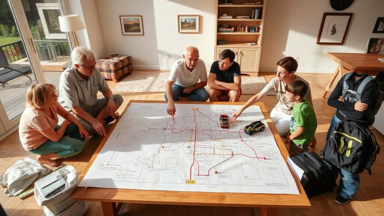
When was the last time your emergency map was put to the test under real conditions? Don’t wait for the next flood to find out if it fails. Testing guarantees map accuracy when lives are on the line. Run simulations during drills to see if evacuation routes update in real time and if flood zones reflect current water levels. Check that GPS markers align with physical landmarks. Gather user feedback from first responders and residents-they’ll tell you if icons are confusing or if critical shelters are missing. Their input often reveals flaws data alone won’t show. Adjust the map based on performance gaps and reports. Retest after changes. A map that works in calm won’t necessarily work under crisis. Only repeated validation guarantees reliability. Test early, test often, and keep refining-your community’s safety depends on it.
On a final note
You need fast, accurate maps when flash floods hit. Use real-time data and local input to build them quickly with tools that update live. Clear symbols and simple layouts keep them readable under stress. Test them in drills to spot flaws before disaster strikes. These maps won’t stop floods, but they do give people a better chance to escape-every second counts.