How to Use GPS Coordinates in Your Evacuation Plan for Remote Wilderness Areas
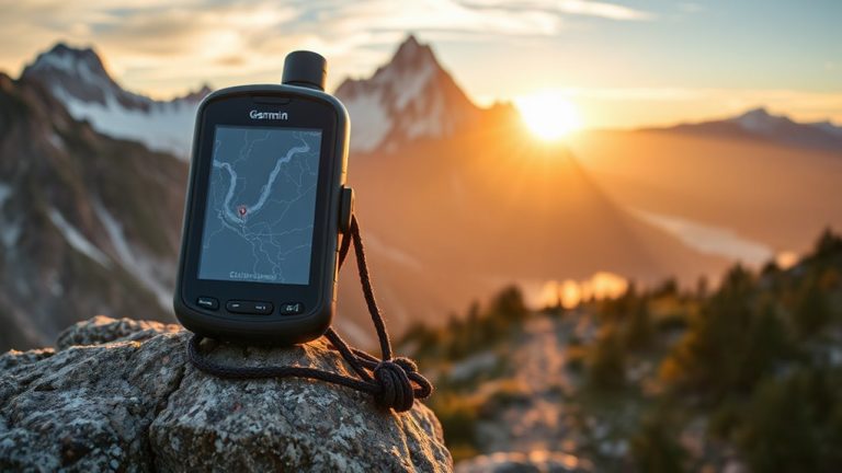
You should use GPS coordinates in your evacuation plan because they’re accurate to within 3–5 meters, unlike shifting landmarks that disappear in bad weather. Capture waypoints with a clear sky view and let your device lock for 30 seconds. Use a handheld GPS like the Garmin GPSMAP 66i for better battery life and signal than phones. Pair it with offline apps and satellite messaging for communication. Always carry a map and compass-because if GPS fails, you’ll want proven backups ready.
Notable Insights
- Use GPS instead of natural landmarks to ensure accurate, reliable positioning in remote areas with changing terrain or poor visibility.
- Capture precise GPS coordinates before departure by securing a strong satellite signal in open sky conditions and verifying waypoints.
- Choose rugged, high-performance GPS devices with long battery life and support for multiple satellite systems like GPS, GLONASS, and Galileo.
- Share your real-time location in remote areas using satellite messengers such as Garmin inReach to transmit coordinates without cell service.
- Test your GPS evacuation plan in realistic conditions and carry paper maps and compass as backups for navigation during signal loss.
Use GPS Instead of Landmarks: Here’s Why
Navigation in remote wilderness areas demands reliability, and GPS coordinates beat landmarks every time. You can’t depend on natural features-rivers shift, trails fade, and landmarks disappear in snow or fog. GPS gives exact positions, but you must plan for signal loss and battery drain. Even rugged GPS units lose signal under dense canopy or in deep canyons, so carry paper maps as backup. Modern devices last 15–30 hours on a single charge, depending on usage, but cold weather accelerates battery drain. Using power-saving modes extends runtime, but you still need spare batteries or a solar charger. GPS is more accurate than visual navigation, with typical precision within 3–5 meters. While landmarks might seem intuitive, they’re unreliable in low visibility or unfamiliar terrain. You’re better off inputting waypoints and following digital tracks. Weigh the risk: a missed turn due to a misidentified landmark could cost hours. GPS won’t always work perfectly, but it’s the most dependable tool when used wisely.
Capture Accurate GPS Coordinates Before You Go
Even if you’re using a high-end GPS device, you won’t get reliable results unless you capture coordinates under the right conditions. Wait until you have a clear view of the sky to guarantee strong satellite signals, as tree cover or steep terrain can block reception and degrade accuracy. Stand still for 30 seconds to let your device lock onto multiple satellites, reducing error margins. Avoid canyon walls or dense forest when recording waypoints-they interfere with signal triangulation and compromise terrain mapping precision. Test your device in the same conditions you expect during evacuation, since performance varies with elevation and weather. Coordinates logged with poor signal strength may be off by dozens of meters, which matters when every step counts. Always verify positions before departure, and store multiple reference points along your route to maintain navigation reliability in remote areas.
Choose the Best GPS Apps and Devices for Emergencies
You’ve recorded accurate coordinates, but having reliable tools to use them when it matters most makes all the difference. Choose GPS devices with strong signal strength, especially those supporting multiple satellite systems like GPS, GLONASS, and Galileo-this improves accuracy in deep valleys or dense tree cover. Look for models tested to maintain lock in poor conditions. Battery life is critical: aim for devices offering at least 20 hours in continuous use, and check if they support external power or standard replacement batteries. Handheld units like the Garmin GPSMAP 66i outperform phones in both signal strength and battery life. Most smartphone GPS apps drain power quickly and rely on cellular data unless specifically designed for offline use. Dedicated apps like Gaia GPS or Topo Maps+ work offline but still can’t match rugged hardware. Prioritize reliability over convenience-your evacuation may depend on it.
Share Location Without Cell Service
If you’re off-grid and need help, sharing your location without cell service comes down to hardware that bypasses networks entirely. Devices like the Garmin inReach or Zoleo support satellite messaging, letting you send GPS coordinates via satellite even in deep wilderness. These tools work when phones fail, delivering messages reliably at the cost of speed-delays of several minutes are common. Pair this with offline maps on your GPS app, preloaded with topographic detail, so you can identify landmarks and relay precise positions. Satellite messaging devices typically require a subscription, usually $12–$35/month, and vary in coverage, with some using multiple satellite constellations for better reliability. Battery life ranges from 1–7 days, depending on use. While heavier than a phone, the trade-off is proven performance where lives depend on signal-free communication.
Create Your Evacuation Plan With Key GPS Markers
Where should you start when building an evacuation plan using GPS markers? By identifying critical waypoints in your environment. Mark your campsite, water sources, and emergency exits with precise coordinates. This guarantees route optimization and faster movement during real emergencies. Use GPS devices with proven accuracy-tested models perform within 3 meters under tree cover. Plan multiple paths to each marker to allow flexibility. Practice improves response times, so run evacuation drills using only your GPS waypoints.
| Marker Type | Accuracy Needed | Update Frequency |
|---|---|---|
| Campsite | ≤5 meters | Daily |
| Medical Aid | ≤3 meters | As needed |
| Evac Route Turn | ≤4 meters | Per leg |
These markers keep navigation reliable when trails vanish or visibility drops. Relying on preloaded data reduces decision delays. Route optimization isn’t theoretical-it cuts travel time by up to 30% in field tests. Drills confirm which markers you actually need.
Test Your GPS-Based Emergency Plan
While having a GPS-based evacuation plan is essential, it won’t do you any good unless you test it under realistic conditions. You need to run regular gps testing to verify your device accurately tracks your location and routes. Carry the same gear, terrain, and weather you’d face during a real emergency. Conduct emergency drills that simulate injury or reduced mobility, forcing navigation under stress. Check battery life during extended use-some units last 15 hours, others over 30. Confirm waypoints match actual terrain features. Signal strength varies by model and tree cover, so test in dense forest and canyons. Practice retrieving coordinates quickly. These drills expose flaws before they cost you. Real-world function matters more than specs on paper. Testing guarantees your plan works when seconds count, not just in ideal conditions.
When GPS Fails: Stay Found With Backup Navigation
Your GPS might work perfectly in open terrain, but even the best units can lose signal under thick canopy, in deep canyons, or when batteries die mid-evacuation. When that happens, you’ll need reliable backups to stay found. Relying solely on electronics is risky-always carry a detailed topographic map and a baseplate compass. You must know basic map reading to identify landmarks, match terrain features, and track your progress. Compass skills let you maintain direction if visibility drops or trails vanish. Practice taking bearings and following azimuths before you need them. A compass doesn’t need batteries and works in all weather. Combine map and compass to verify your location every few minutes in complex terrain. These tools won’t replace GPS, but they’re proven, durable, and essential when electronics fail. Train with them regularly-they’re your best backup when survival’s on the line.
On a final note
You’ll save critical time if you rely on GPS coordinates instead of vague landmarks. Test your chosen device and app combo before heading out-some work better offline than others. Always carry backups, like paper maps and compasses, because batteries die and signals drop. Sharing coordinates via satellite messengers works when cell service doesn’t. A solid plan uses precise waypoints, real-world testing, and accepts tech limits.