Essential Maps and Navigation Tools for Bug-Out Bags
You need a topographic map at 1:24,000 scale-it shows terrain detail GPS can’t when signals drop. Pair it with a baseplate compass that has adjustable declination and a fluid-damped needle; it’s reliable even when batteries die. Use waterproof Tyvek or laminated maps-they survive rain and repeated folding. A digital altimeter helps confirm location, but check its battery every three months. Store all gear dry and shielded from magnets to keep them working when routes get tough. More details on setup and use follow.
Notable Insights
- Use topographic maps at 1:24,000 or 1:50,000 scale for accurate terrain detail and route planning.
- Choose waterproof, tear-resistant maps made from synthetic materials like Tyvek for durability in wet conditions.
- Pack a baseplate compass with adjustable declination and a fluid-filled capsule for precise navigation.
- Store maps in sealed, waterproof cases to protect against moisture and physical damage during emergencies.
- Combine maps and compass regularly; practice land navigation to reduce GPS dependence when signals fail.
Why GPS Fails in Bug-Out Situations
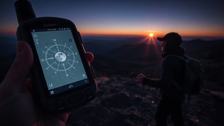
While GPS might seem reliable during routine use, it can fail when you need it most in bug-out scenarios. You’re counting on it, but signal interference from dense forests, urban canyons, or electromagnetic disruptions can block satellite links, leaving you without positioning. Even military-grade units lose accuracy when tree cover or terrain obstructs reception. Battery dependency is another hard limit-most devices last 8 to 20 hours on a single charge, and recharging off-grid isn’t guaranteed. Solar chargers help, but they’re slow and weather-dependent. GPS units also lock onto signals slower in cold or high-altitude environments. When the grid’s down, you can’t rely on continuous connectivity. These tools have value, but their limits are measurable and situational. In extended evacuations, signal interference and battery dependency make GPS an uncertain primary navigation method, no matter the brand or cost.
Topographic Maps for Emergency Navigation
You can’t count on GPS when the signal drops or the battery dies, so having a physical navigation backup makes sense. Topographic maps give you terrain detail that flat road maps can’t match. They use contour intervals to show elevation changes-you’ll need this when choosing routes over hills or around ravines. Map scales determine accuracy; a 1:24,000 scale shows fine detail, while 1:100,000 covers more ground with less precision.
| Scale | Coverage Area | Detail Level |
|---|---|---|
| 1:24,000 | Small | High |
| 1:50,000 | Medium | Moderate |
| 1:100,000 | Large | Low |
| 1:250,000 | Very Large | Minimal |
Choose scales based on terrain complexity. Smaller contour intervals reveal subtle elevation shifts, helping you avoid steep or hazardous ground. These maps work in any condition, no power needed-just practice and a compass.
Choose Waterproof and Durable Survival Maps
If you’re relying on a map in heavy rain or humid conditions, standard paper versions won’t hold up-waterproof and durable survival maps are built for this. Made from synthetic materials like Tyvek or laminated polyester, they resist tearing, moisture, and repeated folding. These materials guarantee long-term map preservation, even with frequent use in harsh environments. Unlike paper, they won’t disintegrate if soaked, making them reliable during extended bug-out scenarios. You can write on them with grease pencils for temporary route planning notes and wipe them clean later. Their durability comes with minor trade-offs: they’re slightly heavier and can be noisier when handled. Still, the longevity and reliability outweigh these downsides. Choose maps with high-resolution topographic detail and clear legends to support accurate navigation. Proper map preservation starts with material choice, and for bug-out situations, that means going waterproof.
What to Look for in a Survival Compass
When traversing off-grid terrain, a reliable survival compass becomes essential, and not all models are built the same. You need one with adjustable magnetic declination to align with your map’s true north-this prevents navigational errors over long distances. A compass without this feature forces mental math, which can lead to mistakes under stress. Needle sensitivity matters too; a high-sensitivity needle settles quickly and responds to subtle directional shifts, improving accuracy. Look for a fluid-filled capsule that damps needle movement without slowing response. A baseplate with ruler edges and a magnifier helps with map work, but don’t sacrifice durability. Luminous markings aid visibility in low light, though they fade over time. Avoid gimmicks like built-in flashlights-they add weight and failure points. Stick to proven designs from reputable brands. Your life might depend on it.
How to Use a Compass With a Map
Though relying solely on a GPS might seem convenient, pairing a compass with a map remains the most dependable method for navigation in remote areas where batteries fail and signals vanish. You must adjust for magnetic declination-the difference between true north and magnetic north-based on your location, or your route planning will drift off course. Align the compass edge with your start and destination points, then rotate the bezel until the orienting lines match the map’s meridians. Here’s a quick reference:
| Step | Action | Purpose |
|---|---|---|
| 1 | Set route on map | Mark direction of travel |
| 2 | Adjust for declination | Align compass with true north |
| 3 | Follow bearing | Stay on planned path |
Accurate declination settings guarantee reliable navigation. Always verify your position using terrain features. This method requires no power and works in all weather, making it essential for effective backcountry travel.
Altimeters and Other Tools for Precision
Since elevation can drastically affect your navigation accuracy, using an altimeter alongside your map and compass helps confirm your position in rugged or featureless terrain. You can track changes in barometric pressure to detect elevation shifts, even in fog or snow where landmarks are hidden. Altimeters provide real-time elevation tracking, letting you match your height to contour lines on topographic maps. This cross-verification reduces guesswork on steep slopes or ridge lines. Most digital altimeters update every few seconds and are accurate within ±20 feet, but they require periodic calibration. Manual models avoid battery dependence but need more skill. Changes in weather also affect barometric pressure, so you’ll need to recalibrate often to avoid drift. While not foolproof, pairing an altimeter with your primary tools increases precision. It’s a pragmatic addition-lightweight, low-power, and functional when GPS fails.
Keep Your Navigation Gear Ready and Protected
You’ll want to protect your map, compass, and altimeter from the start-these tools won’t help if they’re water-damaged, lost, or malfunctioning when you need them most. Use waterproof cases or dry bags for map storage to prevent tearing and moisture exposure. Laminated maps or those in sealed ziplock sleeves survive rain and humidity better. Store your compass in a padded slot to avoid dial misalignment. Check battery levels in digital altimeters every three months and replace them proactively. Metal or magnetic cases can interfere with compass accuracy, so avoid them. Gear maintenance includes wiping tools clean after use and inspecting straps and clasps for wear. A small cleaning cloth and spare parts kit improve longevity. These steps guarantee reliability in emergencies-when navigation errors cost time, energy, or safety.
On a final note
You need reliable navigation when GPS fails. A waterproof topographic map and a baseplate compass with declination adjustment are essentials. Pair them correctly, and you can navigate accurately in any terrain. An altimeter helps confirm elevation changes. Keep all tools sealed and accessible. Durability, accuracy, and simplicity matter most-avoid gadgets that rely on batteries. Test your setup in training; know it works before you need it.