How to Use GPS to Identify Safe Zones in Landslide-Prone Areas
Use your GPS to map slopes over 30%-avoid those with clay soil or sparse vegetation, as they’re high-risk. Track drainage patterns using elevation data; gullies and depressions show where water weakens soil. Flatter areas under 15% grade are safer but check soil and vegetation. Pre-program multiple evacuation routes with offline topographic maps on Garmin or Trimble units. Sync GPS points with GIS software for accuracy. Modern GPS devices with real-time alerts can warn you of ground movement-set them to share location-triggered alerts with your network instantly. You’ll learn how to optimize each step for faster, safer decisions when conditions change.
Notable Insights
- Use GPS to map areas with slopes below 15% grade, which are generally more stable and less prone to landslides.
- Combine GPS elevation data with soil analysis to avoid clay-heavy or water-retentive zones that increase landslide risk.
- Identify safe zones by mapping dense vegetation cover using GPS, as strong root systems enhance slope stability.
- Use GPS to trace drainage patterns and avoid low-lying areas where water accumulation weakens soil structure.
- Pre-program GPS devices with verified stable routes and safe zone coordinates for reliable evacuation planning.
Map Landslide Risks With GPS Data
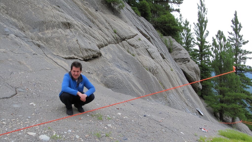
A map isn’t just lines and colors-it’s your first line of defense when landslides threaten. With GPS data, you pinpoint high-risk zones by overlaying soil composition and vegetation cover. Clay-heavy soils retain water and weaken slopes-GPS coordinates help log these areas accurately. Sparse vegetation cover means less root binding, increasing slide risk; use GPS to map bare patches and track changes over time. Handheld units with sub-meter accuracy, like those from Garmin or Trimble, perform well in dense terrain. You’ll need WAAS-enabled devices for better precision. Mapping on the fly works, but sync data with GIS software later for full analysis. Don’t rely on visuals alone-verified GPS points remove guesswork. Mark weak soil zones and denuded areas clearly. This baseline helps you avoid false alarms and missed threats. It’s not foolproof, but it’s factual, repeatable, and essential groundwork.
Analyze Slope and Elevation for Stability
You’ve mapped the risk zones with GPS, now build on that by analyzing slope and elevation-two factors that directly influence stability. Steeper slopes above 30% grade are more likely to fail, especially when combined with weak soil composition like loose clay or saturated silt. Use GPS elevation data to identify sharp changes in gradient, which often signal potential slip planes. Flatter areas below 15% are generally safer, but check soil composition first-sandy or gravelly soils drain better and resist sliding. Elevation also affects water retention; lower zones may accumulate runoff, increasing risk. Dense vegetation cover helps stabilize slopes by anchoring soil with roots, so areas with thick tree or shrub cover tend to be more resilient. Sparse vegetation, especially on inclines, is a warning sign. Combine GPS slope maps with on-site checks of soil type and plant cover to confirm stability. Don’t rely on terrain shape alone-ground truthing improves accuracy.
Track Water Flow Using GPS Terrain Maps
Since water movement often triggers landslides, mapping drainage patterns with GPS terrain data helps pinpoint where runoff accumulates or channels downhill. You can spot weak zones by analyzing terrain drainage features like gullies or depressions that concentrate flow. Persistent water erosion in these areas undermines soil stability, raising landslide risks. GPS maps with elevation contour layers let you trace flow paths accurately, even in dense vegetation. Focus on where water converges-these spots face faster erosion and are less reliable during heavy rain. Flat areas downstream or beside intense flow zones aren’t safe either. Instead, target locations where terrain drainage spreads out or stops. Mapping these patterns doesn’t prevent landslides, but it reduces guesswork. You’ll know where water erosion has likely compromised the ground, letting you choose safer ground with better natural runoff dispersion.
Find Safe Escape Routes With GPS
Mapping water flow gets you partway there, but knowing where to go when danger hits matters just as much. GPS helps you identify safe paths before emergencies, marking routes that avoid slopes, ravines, and known slide zones. Pre-program your device with multiple evacuation options so you’re not guessing under stress. Route optimization tools in most GPS apps analyze terrain, distance, and elevation to suggest the fastest, most stable exits. Test these routes during dry conditions to confirm accessibility and update them if roads erode or trails close. Not all GPS units perform equally-models with topographic mapping and offline capability deliver better reliability. Battery life and signal strength are real trade-offs; carry backups. Using GPS to plan and verify safe paths means you’re not relying on instinct when seconds count. It’s practical prep, not overkill. For reliable navigation in remote areas, consider investing in one of the best GPS devices for hiking.
Enable Real-Time Landslide Warnings
What if your GPS could alert you before the ground gives way? Modern systems now monitor seismic activity and soil saturation levels in real time, triggering warnings when thresholds are breached. You’ll get alerts seconds to minutes before a slide, depending on sensor proximity and network speed. Units with built-in accelerometers detect ground vibrations, while moisture sensors feed data on waterlogged terrain. When combined with GPS location tracking, these inputs help confirm high-risk zones. The device won’t stop a landslide, but it gives you a head start. Response times vary-some systems deliver warnings in under 10 seconds; others may lag during heavy rain due to signal interference. Accuracy improves when devices sync with regional geological networks. You’re not relying on guesses; you’re reacting to measurable changes. It’s not foolproof, but it’s better than waiting until the ground moves.
Share GPS Safety Alerts With Your Network
How much faster could you respond if everyone in your group got the same warning at the same time? Sharing GPS safety alerts instantly with your network cuts reaction time. Most GPS apps let you broadcast your location and warnings with one tap. You can pre-load emergency contacts so alerts go straight to them. When landslides strike fast, seconds matter-automated messages beat manual calls. Enable community alerts to receive updates from local authorities and nearby users. These inputs often include real-time ground movement reports, improving accuracy. Not all systems support group sharing, so test this feature before relying on it. Some apps deliver alerts only if devices are connected to data, but others use SMS fallback. Pair GPS alerts with designated meeting points so your network acts as a unit. Reliable coordination reduces confusion and increases survival odds during rapid evacuations.
Use Offline Maps When Signals Fail
Even if your GPS signal drops during a landslide, you won’t be left blind as long as you’ve downloaded offline maps ahead of time. Offline navigation keeps you oriented when networks fail. Enable map caching in apps like Google Maps or Gaia GPS before entering high-risk zones. This stores regional topography, trails, and safe zones directly on your device. You’ll still see your location and route without data. Plan downloads when Wi-Fi is reliable-cached maps use minimal storage but boost survival odds. A reliable hiking GPS device can provide critical navigation support in extreme conditions.
| Feature | Benefit |
|---|---|
| Offline navigation | Works without signal |
| Map caching | Saves battery and data |
| Preloaded terrain | Identifies safe routes |
| GPS tracking | Updates location in real time |
Don’t rely on live signals in remote areas. Test offline navigation before you need it.
On a final note
You can rely on GPS to locate safer ground in landslide zones. It maps slope angles and drainage paths accurately, helping you avoid high-risk spots. Real-time tracking improves evacuation timing, while offline maps keep working when signals drop. Sharing coordinates speeds up rescue. Just know GPS won’t predict landslides-combine it with local alerts and terrain checks for best results. Accuracy depends on device quality and updated data.