How to Use a Paper Map and Compass When GPS Is Unavailable
You can navigate reliably with a map and compass when GPS fails. First, orient your map using the compass and adjust for declination. Find your route’s bearing, follow it with pace counting, and use handrails like trails to stay on track. Confirm your location by triangulating landmarks. These tools work in any weather and don’t rely on batteries. Mastering them in safe terrain prepares you for real emergencies. There’s more to optimizing each step than most realize.
Notable Insights
- Align the map with true north by using your compass and adjusting for magnetic declination shown on the map.
- Determine your location by identifying visible terrain features and matching them to the map’s contour lines and symbols.
- Set a bearing by aligning the compass baseplate between your position and destination, then adjust for declination.
- Navigate using handrails like trails or rivers, and watch for catching features to avoid overshooting your target.
- Confirm your position by taking back-bearings to known landmarks and triangulating your location on the map.
Understand Topographic Maps Before You Navigate
A topographic map gives you the lay of the land, showing elevation, terrain features, and natural or man-made structures through contour lines. You’ll rely on map scales to judge real-world distances-like 1:24,000, where one inch equals about 2,000 feet on the ground. That precision matters when planning routes. Contour intervals, often 20 or 40 feet, tell you how quickly elevation changes. Closer lines mean steeper slopes; wide spacing suggests gentle terrain. You can misjudge a climb if you ignore these values. Study the legend to confirm both scale and interval-they vary between maps. Flat areas may use small intervals, while mountainous regions use larger ones to avoid clutter. Always check them before moving. These details give you accurate ground assessment, no guesswork. Without understanding map scales and contour intervals, your navigation becomes unreliable, even with perfect compass use.
Orient Your Map With a Compass in 3 Steps
You’ve learned how to read elevation changes and scale on a topographic map, so now it’s time to align that map with your surroundings using a compass. First, place your compass flat on the map and turn the bezel until the orienting lines run parallel to the map’s north-south grid lines, aligning with true north. Second, adjust for magnetic declination-check the map’s declination diagram and rotate the bezel the correct number of degrees east or west to account for the difference between true north and magnetic north. Third, rotate your entire body with the map and compass until the compass needle aligns with the orienting arrow. Now, the map matches your terrain. This method works reliably in any terrain as long as you apply the local declination. No GPS needed-just precision and patience.
Set a Bearing and Follow It Accurately
Grab your compass and find the direction you need to travel by setting a bearing. Rotate the compass bezel so the arrow points to your desired direction on the map. Align the baseplate with your starting point and your destination. Remember to adjust for magnetic declination-check your map’s margin for the value and add or subtract degrees accordingly. Hold the compass level, turn your body until the needle aligns with the orienting arrow, and follow the direction-of-travel arrow. Pick a distant landmark in that line of sight and walk to it. Use pace counting to track distance; count every other step as one pace-roughly 30 inches on flat terrain. This method keeps you on track across open ground. Accuracy depends on consistent alignment and regular checks. Errors grow with distance, so verify often. This approach works when GPS fails and precision matters.
Navigate Using Handrail and Catching Features
When moving through complex terrain, it’s smart to use linear landscape features like trails, rivers, or ridgelines as handrails-these act as reliable guides that keep you on course without constant compass checks. This method, known as handrail navigation, simplifies travel by allowing you to move quickly while staying oriented. Just follow the feature on the map, matching your progress as you go. When your target lies off the handrail, use catching features-distinct terrain marks like lakes, roads, or cliffs-placed beyond your destination to stop you from overshooting. These act as safety nets, confirming you’ve gone too far if you reach them. Handrail navigation paired with catching features reduces errors in low visibility or dense woods. It’s not foolproof-terrain interpretation is essential-but it’s efficient and dependable when used correctly. Combine them with periodic map checks to stay on track.
Find Your Location With a Compass and Landmarks
How do you pinpoint where you are when the trail vanishes and the terrain looks the same in every direction? Use the triangulation method with your compass and visible landmarks. First, spot two or three distinct features-like peaks or towers-you can also identify on your map. Take a bearing to each, then adjust for magnetic declination-the difference between true north and magnetic north-using the value printed on your map. Plot each adjusted bearing as a back-bearing line from the landmark on your map. Where the lines cross is your approximate location. Accuracy depends on precise alignment and correct declination adjustment. The larger the angle between bearings, the better. This method works reliably in clear visibility, but errors increase if landmarks are too close together or bearings are misread. It’s a fundamental skill that doesn’t rely on signals or batteries.
Practice Map and Compass Skills in Safe Terrain
Start in familiar, low-risk areas like local parks or well-marked trails where getting lost isn’t a real danger. This is where you build basic skills without high stakes. Use your map and compass to follow trails, identify landmarks, and confirm your position every few minutes. It’s real world practice that turns theory into reliable habit. You’ll make mistakes, but here, they’re lessons, not emergencies. Adjust your bearing as terrain changes, and check your map alignment regularly. These repeated actions improve accuracy and speed over time. Practicing in safe terrain lets you test your tools and your technique under simple conditions before moving to more complex environments. There’s no substitute for walking while traversing-your body learns the rhythm. Don’t rush progression. Master basic skills first. Real world practice in low-risk settings sharpens judgment and builds confidence without risk.
Why You Shouldn’t Rely on GPS Alone
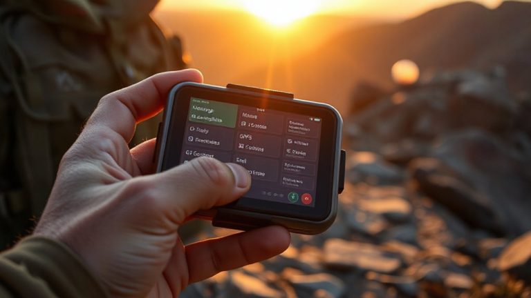
You’ve built your skills in safe areas, learning to read the land and trust your map and compass without pressure. Now it’s time to rely on them-because GPS isn’t fail-safe. Signal loss happens in canyons, dense forest, or bad weather. Battery failure leaves you stranded with no backup. Electronics fail when you need them most.
| Issue | GPS Device | Paper Map & Compass |
|---|---|---|
| Signal loss | Stops working | Unaffected |
| Battery failure | Useless after power dies | Needs no power |
| Durability | Breaks if dropped or wet | Works soaked or torn |
| Weight | Moderate (with spare batteries) | Lightweight, no extras |
You don’t need hype to see the facts. A GPS is helpful, but it’s only one tool. When tech fails, your training and analog tools get you home.
On a final note
You’ll use your compass and map when GPS fails, which happens more than you think. Paper doesn’t need batteries, and a $20 compass works in storms and dense tree cover. You’ve practiced on easy terrain, so you can orient the map, set bearings, and track progress with handrails. These skills take under an hour to learn but can save your life. Relying only on GPS is risky-always carry a topo map and know how to read it.