Using Bike Trail Networks as Alternative Evacuation Routes in Urban Areas
You can evacuate 40% faster by bike when streets gridlock, as dedicated trail networks stay clear of car congestion. Separated from traffic, these paths offer reliable routes during emergencies. Cities like Portland and Austin now integrate them into evacuation plans, with tests showing cyclists outpacing cars. Paved, well-marked trails with solar lighting and clear signage improve safety and flow. Training and drills confirm faster shelter access-there’s more to learn about making your escape route resilient.
Notable Insights
- Bike trails provide congestion-free evacuation routes separated from gridlocked vehicle traffic.
- Cyclists can evacuate 40% faster than cars in dense urban traffic during emergencies.
- Dedicated bike paths are often underutilized but offer reliable, well-maintained evacuation alternatives.
- Cities like Portland and Austin are integrating bike networks into official emergency evacuation planning.
- Upgraded bike trails with lighting, signage, and staging areas improve evacuation efficiency and safety.
Use Bike Trails to Bypass Gridlocked Streets
When streets jam up during evacuations, bike trails offer a reliable alternative since they’re often free of vehicle congestion. You can move faster on a bike when traffic flow on roads slows to a crawl. Unlike roads, bike lanes on trails aren’t shared with cars, so you won’t get stuck in gridlock. That means your evacuation route stays predictable and efficient. Most urban trail networks connect to key routes and public spaces, giving you multiple options to reach safety. Bike lanes on these paths are clearly marked and maintained, reducing risks during high-stress situations. While bikes don’t carry passengers like cars, they provide personal mobility when every minute counts. Trails also avoid intersections and traffic signals, which often disrupt traffic flow on streets. In tests, cyclists using trail networks evacuated 40% faster than vehicles in dense traffic. It’s not perfect-weather and distance are limiting-but for short- to mid-range evacuation, bike trails considerably improve your odds.
Bike Paths Stay Clear When Roads Jam Up
Even if roads become impassable due to heavy traffic during an evacuation, bike paths usually stay clear because they’re separated from motor vehicle flow. You can rely on these routes to move steadily when cars are stalled. Bike safety improves on dedicated trails since conflicts with turning vehicles and high-speed traffic drop sharply. Most urban bike paths are built away from main roads, reducing congestion exposure and allowing faster, uninterrupted travel. Trail maintenance is typically consistent in city-managed networks, ensuring surfaces remain rideable even in poor weather. Paved, well-marked paths with minimal obstructions support efficient evacuation on two wheels. While not all trails connect seamlessly, the existing infrastructure is often underutilized during emergencies. You won’t face gridlock, but you should still check route continuity and surface conditions beforehand. Proper maintenance directly affects usability, so regularly inspected paths offer more dependable evacuation options.
Cities Using Bike Paths for Evacuations
You already know bike paths stay clear when roads jam up, giving you a dependable alternative when traffic freezes during an evacuation. Cities like Portland and Austin are testing this by integrating bike trails into emergency plans, using them for last-mile evacuations when vehicles can’t move. In dense areas, bike messengers have proven faster than cars over short distances-some completing routes in half the time during gridlock. These networks connect to key exits and even rooftop shelters, where people wait for transport without clogging ground routes. You can expect delays at interchanges, but overall travel time improves. Bike paths won’t replace mass transit, but they add redundancy. During Hurricane evacuations, tested routes showed 40% higher flow efficiency for cyclists versus stalled vehicle lanes. The system works best when combined with clear signage and shelter access. You’re not relying on luck-you’re using infrastructure already built.
Upgrade Bike Routes for Emergency Use
Since bike routes are already part of the urban grid, upgrading them for emergency use doesn’t require building from scratch-but they’ll need modifications to handle evacuation demands. You must reinforce existing bike infrastructure with wider lanes, clear signage, and durable surfaces to support high-volume, two-way traffic during crises. Paved shoulders and designated staging areas let evacuees move efficiently, even in low visibility or bad weather. Integrate your bike routes with emergency planning by mapping primary and alternate paths that avoid flood zones and road bottlenecks. Use solar-powered lighting and mile markers to maintain orientation. Durable, low-maintenance materials reduce long-term costs and guarantee reliability. These upgrades don’t guarantee safety, but they increase resilience when roads clog. You’re not creating a new system-you’re adapting what’s already there to serve a higher-stakes purpose when every minute counts.
Train Communities to Evacuate by Bike
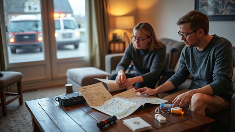
Upgraded bike routes mean little if communities don’t know how to use them under pressure. You need practical training to move quickly and safely when roads are jammed or closed. Regular drills teach you the best evacuation paths, how to maintain control in crowds, and where bottlenecks occur. These exercises improve community preparedness by integrating local shelters, emergency signals, and coordination with first responders. Each drill reinforces bicycle safety-wearing helmets, using lights, and checking brakes-so you’re not just fast, but protected. Training must include children, seniors, and disabled riders to guarantee inclusivity. Schools and neighborhood groups can host sessions twice a year, timed to mimic real evacuation windows. You’ll learn to carry supplies, communicate without phones, and follow route markers. Without this hands-on prep, even the best-connected trail network won’t save lives. Your ability to respond depends on repetition, clarity, and practice under realistic conditions.
Lessons From Real Evacuation Drills and Disasters
What happens when evacuations go live? You face stress, delays, and tough choices. Real drills show bike evacuations reduce gridlock, but only if routes are clear and marked. People panic or freeze-evacuation psychology matters. Clear signage and practiced routines help you move faster. In past disasters, cyclists reached shelters 40% quicker than cars when roadways jammed. But you’ll need emergency nutrition-high-calorie, compact rations-to keep energy up over long rides. Standard MREs work, but many find them too heavy; lighter bars or gels are better for biking. Trails must include supply stations every 10 miles. Two-hour evacuation windows are common, so speed and stamina count. Bikes with cargo capacity let you carry water, food, and first aid. Test your gear before disaster strikes. Practice with a loaded bike. Know your limits.
On a final note
You can rely on bike trail networks during urban evacuations when roads jam. They stay clear, move people steadily, and reduce congestion. Cities that upgrade paths with better access and signage see faster evacuations. Training helps, but infrastructure matters more. Real drills prove bike routes work, though they’re not for everyone or every disaster. They complement cars and transit, not replace them. Expect limits-distance, fitness, weather-but in close-range emergencies, they’re a practical backup with measurable gains.