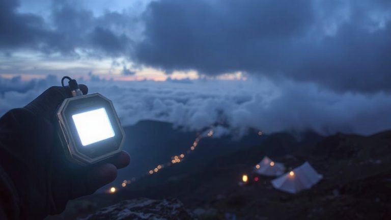
How Satellite Devices Provide Emergency Communication in Volcanic Zones
You rely on satellite devices in volcanic zones because they keep working when cell towers fail or terrain blocks signals. Devices like the Garmin inReach Mini 2 use the Iridium network to send SOS and text via orbiting satellites, even during ash storms. They’re rugged, survive drops and extreme temps, and use L-band frequencies to punch through interference. GPS stays online, and two-way messaging works where phones die. With daily testing and spare power, these tools stay reliable-knowing the best options can make the difference when seconds count.
Notable Insights
- Satellite devices use orbital networks like Iridium to maintain communication when ground-based systems fail during volcanic eruptions.
- Rugged, IP67-rated satellite messengers withstand extreme heat, ash, and impacts common in volcanic environments.
- L-band frequencies enable signal penetration through ash clouds and atmospheric disturbances caused by eruptions.
- Two-way satellite messaging allows emergency coordination even when cellular networks are completely down.
- GPS-enabled SOS alerts provide precise locations for rescue, critical when evacuation time is limited.
Why Volcanic Zones Rely on Satellite Communication
While ground-based networks often fail in remote or extreme environments, you’ll find satellite communication is the only reliable option in volcanic zones, where eruptions, seismic activity, and rugged terrain routinely destroy traditional infrastructure. You’re working in areas with limited infrastructure, so wired or cellular systems aren’t viable. Power outages and ash interference further degrade local networks. Satellite links bypass ground dependencies, offering consistent connectivity regardless of surface conditions. In remote locations, where response time is critical and access is difficult, these systems provide essential coordination for evacuation and monitoring. They don’t rely on local towers or grid power, meaning they stay operational when other methods fail. Though bandwidth may be lower and latency higher than urban networks, the trade-off is necessary. For basic messaging, GPS tracking, and emergency alerts, satellite communication delivers measurable reliability where alternatives simply don’t exist.
Best Satellite Devices for Volcanic Emergencies
What’s the right satellite device when minutes matter and the ground’s falling apart beneath you? Start with the Garmin inReach Mini 2-it’s tough, compact, and built for extreme environments. Its device durability is proven in drop and temperature tests, surviving shocks and moisture that would cripple lesser gear. When volcanic ash disrupts local signals, its signal reliability stays strong via the Iridium network, offering near-global coverage. The Zoleo Satellite Communicator is lighter and cheaper but depends on pairing with your phone-convenient, but one more thing that could fail. For longer missions, the Thuraya X5-Touch delivers solid device durability and voice capability, though its coverage is limited to Europe, Africa, and Asia. Signal reliability across multiple satellites gives it an edge in remote zones. No device works perfectly in every eruption scenario, but these models balance rugged design and consistent signal reliability when you need them most.
How Satellite Messengers Work During Eruptions
When volcanic activity disrupts local infrastructure, satellite messengers bypass damaged ground networks by connecting directly to orbiting satellites, so your messages still get through. You rely on these devices when cell towers fail, and signal interference from ash clouds or electromagnetic disturbances could block regular communication-yet satellite links often remain stable. Your device sends a compressed signal upward, where satellites relay it to ground stations, enabling basic texts or SOS alerts. Most messengers use L-band or similar frequencies, which better penetrate atmospheric disruptions. Device durability matters: models with IP67 or higher ratings resist dust, moisture, and impacts common in eruptions. They operate in extreme temperatures, but battery life drops in cold, high-altitude zones. GPS accuracy may degrade slightly during heavy interference, but location sharing generally works. You won’t stream data, but you can send brief, critical updates. These tools don’t guarantee success, but they improve survival odds when terrestrial systems fail.
Real Rescue Stories From Volcanic Zones
Because terrain and weather often worsen after an eruption, satellite messengers prove useful where other tools fail. You’re on the slope when sensors alert you to rapid lava flow tracking, giving you 12 minutes to move-your device sends an SOS with GPS coordinates before ash disrupts ground signals. In Iceland, a hiking team used theirs to escape a sudden fissure eruption, relying on preloaded topographic maps and continuous ash cloud monitoring to navigate visibility under 50 meters. In 2022, Guatemalan authorities rescued three researchers after their device pinged hourly updates through pyroclastic activity, confirming stable positions despite network blackouts. These cases show reliable two-way messaging works when cellular coverage drops. Devices with long battery life and direct satellite links outperform smartphones with offline modes. You won’t get instant rescue, but you’ll be found faster. Lava flow tracking and ash cloud monitoring integrate with alert systems, letting you act before evacuation routes close. Real data saves lives-when seconds count, your device becomes the most critical tool you carry.
Safety Tips for Using Satellite Devices Near Active Volcanoes
Even if you’re relying on a satellite device, don’t assume it’ll work instantly in extreme volcanic conditions-you still need to plan for signal delays, battery drain, and device limitations. Signal interference from ash clouds and electromagnetic activity can disrupt transmission, so test your device daily. Prioritize models with proven device durability, like those rated IP67 or higher, to withstand heat, dust, and moisture. Carry spare batteries or a solar charger-cold ambient temps reduce battery life fast.
| Feature | Why It Matters |
|---|---|
| GPS + SOS combo | Guarantees accurate location tracking during evacuation |
| Rugged casing | Maintains device durability under sudden temperature shifts |
| Low-signal mode | Reduces power use during signal interference |
Keep the device in an outer pocket for quick access. Avoid metal shielding-your backpack could block signals.
On a final note
You need reliable communication in volcanic zones, and satellite devices deliver when cell networks fail. Models like the Garmin inReach Mini 2 offer two-way texting, GPS tracking, and global coverage. They work during eruptions if the sky is partially visible. Battery life lasts 7–14 days, depending on use. While heavier than phones, they’re rugged and proven in real rescues. Choose satellite over terrestrial systems for survivability in extreme conditions.