How to Evaluate Your Home’s Exposure to Urban Flooding
You’re at higher risk if your home is near a river or in a low-lying area, especially if historical flood maps show past water events nearby. Check for pooling after rain-consistent puddles mean poor drainage. Look at street-level drains; clogged or slow ones can’t handle heavy flow. Compare your yard’s elevation to neighbors’-even a small dip increases risk. City flood zone maps and aging infrastructure data reveal long-term exposure. Hidden vulnerabilities become clear over time.
Notable Insights
- Check historical flood records and FEMA maps to identify if your property lies in a high-risk flood zone.
- Observe water pooling in your yard or street after rain to spot poor drainage areas.
- Inspect block-wide drainage by noting standing water near storm drains or sunken street sections.
- Assess your property’s elevation relative to surroundings, as lower areas collect more runoff.
- Review urban planning data for flood zones and outdated infrastructure that increase flooding risks.
Find Past Flooding Near Your Home
Ever wonder if the house you’re looking at has a history of flooding? You should. Start by checking local flood records-many cities keep logs of past incidents. High flood frequency in the area means a greater chance of repeat issues. Look up historical rainfall data; areas with steady, heavy rains over decades often exceed drainage capacity. That doesn’t guarantee flooding, but it raises the risk. Public databases like FEMA’s flood maps or the USGS water portal provide measurable trends, not guesses. Near-river homes or low-lying zones with repeated water events are red flags. Even if the home itself hasn’t flooded, nearby patterns matter. Past performance isn’t perfect, but it’s one of the best predictors. Don’t skip this step-flood frequency and historical rainfall give you hard evidence, not opinion. Use them to judge real exposure, not just curb appeal.
See Where Water Pools After Rain
Why does water collect in certain spots after a storm? Because of how storm patterns and soil saturation interact. After heavy rain, you’ll notice pooling in low areas where water naturally flows. These spots stay wet longer when the ground’s already saturated, meaning it can’t absorb more. You don’t need special tools to see this-just check your yard and nearby streets soon after it rains. Persistent puddles signal poor drainage. Areas with compacted soil or clay show slower absorption, increasing pooling. Observing this over several storms reveals consistent problem zones. Storm patterns vary, so repeated observation improves accuracy. You’re not just looking for wet spots-you’re tracking how fast water accumulates and how long it lingers. That tells you about soil saturation levels and how your property handles runoff. It’s a simple, direct way to gauge flood risk without guesswork. Use what you see to decide where action’s needed.
Spot Drainage Failures on Your Block
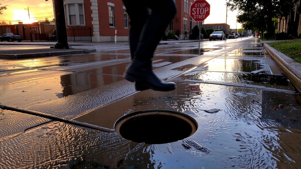
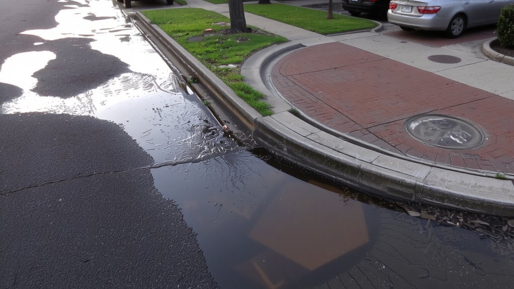
While standing water in your yard is a clear sign of trouble, looking beyond your property line gives you a fuller picture of drainage issues. Walk your block after a rain and check if water pools near curb-level storm drains. If drains are clogged or too few, water won’t exit fast enough, increasing flood risk. Notice if multiple areas collect water in the same spots-this often means poor street grading. Proper grading should slope toward drains, but aging roads or bad design can reverse the flow. Flat or sunken street sections usually can’t shed water efficiently. You don’t need heavy rain for problems to show; even light storms reveal weak points. If your block has slow drainage or overwhelmed storm drains regularly, you’re likely at higher risk when bigger storms hit. Observing these patterns helps gauge real-world performance, not just assumptions. Installing temporary flood barriers can help protect your home during heavy rainfall if your area is prone to drainage failures.
See If Your House Sits in a Low Spot
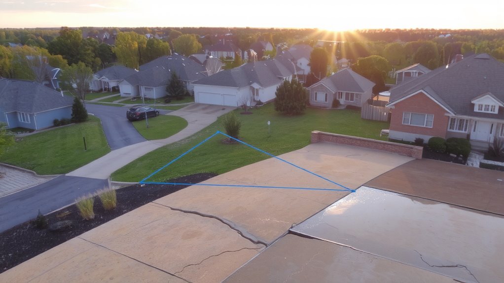
How much lower is your yard than your neighbors’? Even a small difference in elevation levels can make your property more prone to pooling water. If your home sits in a dip, it’s likely collecting runoff from surrounding areas. Check the terrain contours by walking the block after heavy rain-see where water flows and where it stops. If it collects near your foundation, you’re in a low spot. Houses positioned at the bottom of a slope often face this issue. You don’t need precise survey tools; visual clues work. Look for stains on walls, muddy patches, or compacted dirt. These signs point to repeated water exposure. While minor elevation changes may seem insignificant, they impact drainage. Being just a foot lower than nearby yards increases flood risk. Adjust landscaping or consider drainage solutions if your home consistently traps water. Installing temporary flood barriers can provide added protection during heavy rainfall events.
Use City Maps to Check Urban Flood Risk
You’ve checked your yard’s elevation and walked the block after a storm to see where water settles, but that’s just your immediate view. City maps give you the broader picture. Most municipalities offer online flood zone maps that show where stormwater historically collects and which areas are classified as high-risk. These maps use data on topography, drainage patterns, and infrastructure age to assign flood zones. Older neighborhoods often have outdated storm drains and combined sewers that increase overflow risk during heavy rain. Even if your street seems dry, being in a mapped flood zone means you’re statistically more exposed. Check your address against official floodplain maps-they’re updated periodically and reflect changes in land use and system capacity. Don’t assume your home is safe just because it hasn’t flooded yet; flood zones and aging infrastructure together reveal long-term risk better than memory or anecdote.
When to Install Barriers or Get Flood Insurance
A solid majority of homes in mapped flood zones don’t have flood insurance, leaving thousands underprotected when heavy rains hit. If your home is in a high-risk area, buying flood insurance before the next storm season is a practical step-standard policies take 30 days to activate. Installing temporary barriers like inflatable dams or sandless flood sacks makes sense if you’ve had water enter before; they’re effective up to 3 feet of inundation. Pair them with flood sensors to get alerts when water reaches your foundation. These sensors cost $50–$150 and connect to your phone, giving early warnings. Keep emergency kits near exits-include water, meds, flashlights, and copies of key documents. Barriers buy time but aren’t foolproof. Insurance reduces financial risk but won’t stop damage. Weigh past flood history, elevation, and drainage to decide. Consider reviewing the Top Flood Barriers & Buying Guide to choose the most effective solution for your home’s specific vulnerabilities.
On a final note
You can’t stop heavy rain, but you can act on what the land and drains tell you. Check past floods, see where water collects, and study city risk maps. If your home sits low or nearby drains fail, flooding’s likely. Barriers help, but they’re no guarantee. Flood insurance covers losses, not prevention. Know your risk, then decide-protect or prepare, based on facts, not luck.