How to Navigate Using Geological Fold Lines in Mountain Terrain
You can navigate rugged terrain by following mountain folds-anticlines form ridges, synclines create valleys, both offering predictable pathways. Use topo maps with 20- to 40-foot contours to spot these patterns, and match them to geologic maps showing rock age and type. Fold lines remain visible in poor visibility, guiding your route when GPS fails. Align compass bearings with strike directions to stay on track. There’s more to using folds effectively where terrain gets tricky.
Notable Insights
- Recognize anticlines as ridges with symmetrical slopes and oldest rocks to identify high ground for navigation.
- Follow synclines as natural valleys with younger rocks, offering smoother, water-carved travel routes.
- Use topo map contour lines and geologic maps together to match fold patterns with terrain features.
- Navigate along fold axes, using mirror-image slope patterns to stay aligned with the fold structure.
- In poor visibility, maintain direction by aligning compass bearings with the strike of exposed fold layers.
Why Mountain Folds Are Your Navigation Secret
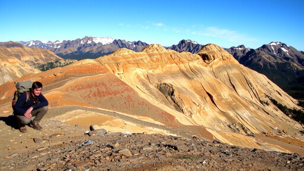
Why rely on GPS when the land itself offers a more reliable map? Mountain folds form consistent, visible patterns that won’t fail when batteries die. You can track your position using anticlines and synclines, which show up clearly in ridge lines and valley shapes. Unlike digital tools, these features aren’t thrown off by magnetic declination, a common issue when compass readings don’t align with true north. Topo maps use contour intervals to represent these folds accurately, typically at 20- to 40-foot increments, letting you estimate elevation changes reliably. When visibility drops, reading the folds gives you orientation without signal or calibration. GPS may glitch; rock layers don’t. Learning to interpret fold lines means you always carry a working map. It’s not flashy, but it’s functional. In navigation, that’s what matters-consistency, accuracy, and independence from fragile tech.
How To Spot Anticlines And Synclines On The Trail
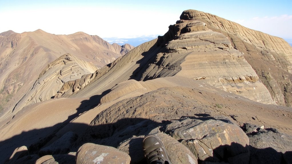
Where do you start when identifying folds on the ground? Look at how rock layers bend and tilt. In anticlines, layers arch upward, so their oldest rocks sit in the center, and erosion patterns expose them as ridges with symmetrical dips outward. Synclines curve downward, holding younger rocks in the middle, often forming valleys where layers slope inward. You can trace these forms by watching how weathering cuts across the landscape-ridges often follow resistant beds in anticlines, while soft layers in synclines erode faster. Check slopes on both sides of a ridge or valley; if they mirror each other, you’re likely seeing a fold axis. Pay attention to consistency in layer orientation over distance. Erosion patterns won’t always reveal the full structure, but combined with visible rock layers, they provide reliable clues. Use this to confirm fold types as you move.
How Folds Shape Slopes And Guide Routes
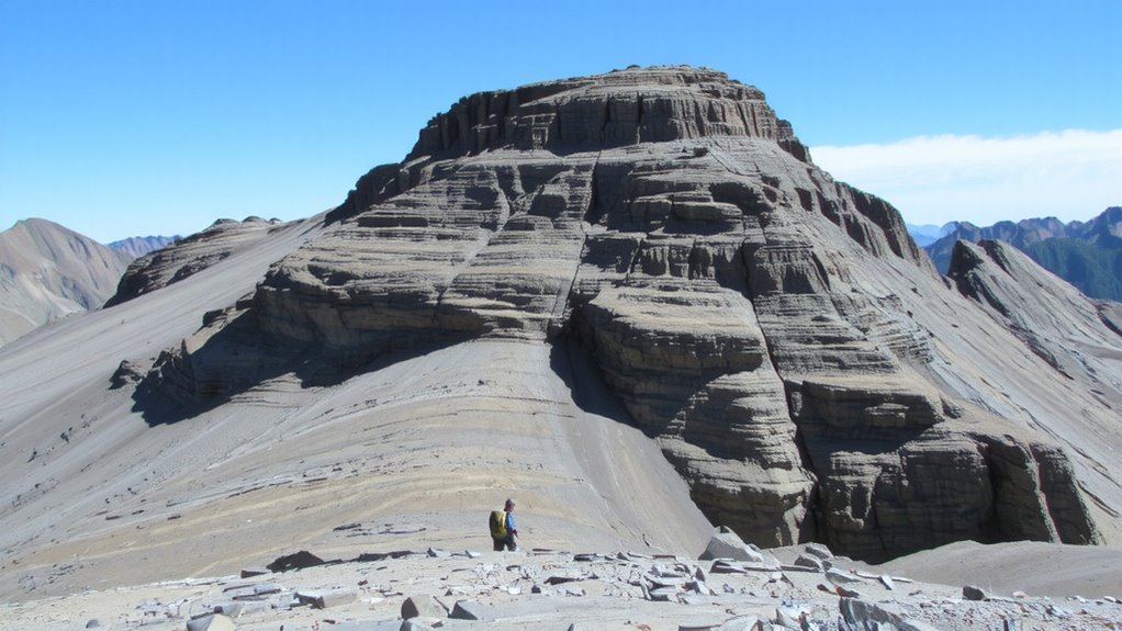
You’ve learned to spot anticlines and synclines by their rock patterns and erosion clues, and now you can use that knowledge to read the land underfoot. Folded rock layers tilt and bend, shaping slopes you can follow or avoid. Anticlines often form ridges with steep, resistant rock layers exposed on top, guiding your route along their spine. Synclines bend downward, creating valleys where softer layers erode faster, forming natural pathways. Erosion patterns reveal which layers are strong or weak-resistant sandstones form cliffs, while shales wear into gentler slopes. Following a syncline’s axis may lead you through a smoother, water-carved trail. Crossing an anticline means climbing over tougher, fractured rock. These folds aren’t just features on a map; they dictate slope stability, trail options, and travel difficulty. Read the folds, and you’ll see which way the ground naturally leads.
Use Topo And Geologic Maps Together
A map isn’t just a picture-it’s a tool set. You combine topo and geologic maps to see both shape and substance. Contour lines show elevation, but rock type tells you what’s underfoot-limestone erodes differently than quartzite, affecting slope stability and footing. Matching ridges and valleys on the topo map with fold patterns on the geologic map lets you predict terrain. Geological age helps: older rocks often form cores of folds, more resistant and higher. Younger layers may erode faster, creating gentler slopes. When the two maps align, you confirm your location without GPS. Misalignment? Check strike and dip symbols. Overlaying both maps isn’t optional-it’s essential. You’ll move faster, avoid false ridges, and trust your route. It’s not guesswork. It’s reading the land as layers, not just lines.
Navigate Without Trails: Read Folds In Fog Or Snow
How do you stay on course when the trail vanishes under snow and fog hides every landmark? You rely on fold patterns in the rock, visible even in poor visibility. When you can’t see far, use compass bearings to follow the strike or dip direction of dominant folds. These geological lines act as natural guides across featureless slopes. Dead reckoning becomes essential-track distance traveled and direction from your last known point. Pace counting and time estimates, combined with consistent compass bearings, keep you aligned with expected fold orientations on your map. Fold ridges and valleys don’t shift, so their alignment remains reliable. Check your progress against the expected sequence of folds. Move deliberately, recalculating bearings at likely terrain shifts. Even in whiteouts, the land’s structure gives you reference. Stay precise with bearings and pacing, and you’ll maintain orientation when all else disappears.
Avoid These Common Fold Navigation Mistakes
Staying on course using fold patterns works when visibility drops, but even reliable rock structures can lead you astray if misread. You might follow a plunging fold line confidently, only to realize you’ve drifted off route because you ignored magnetic declination. Map bearings and compass readings don’t match up if you skip adjusting for declination, especially in areas where the difference is over 10 degrees. That small error compounds fast over distance. Also, don’t mistake false summits for your target peak-fold ridgelines often create multiple high points that look final from below. Relying solely on elevation gain can trick you into stopping too soon. Always cross-check your position with topographic contours and strike direction. Fold patterns are useful, but they’re not foolproof. Combine them with accurate compass work and terrain analysis to avoid costly detours or missed routes.
On a final note
You can spot folds in mountain terrain by checking ridge lines and slope patterns. Anticlines form high, tight ridges; synclines create broad valleys. Use topo maps with geologic overlays to confirm orientation. In fog or snow, fold lines still guide movement, but misreading them leads to wrong turns. They’re reliable only when you cross-reference with elevation and strike direction. Folds aren’t trails-they suggest routes, not guarantees.