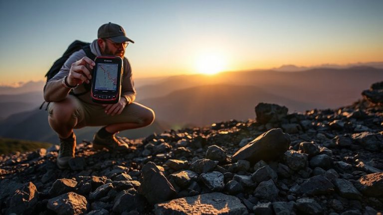
How to Navigate Using GPS in Urban Rubble After Disasters
Calibrate your GPS weekly by placing it in an open area for ten minutes to reduce drift and maintain accuracy when routes shift under rubble. Download offline maps of key zones like downtown and shelters using apps like OsmAnd, since they work without cell service. Use Battery Mode early-30% brightness and 30-second updates can extend runtime to 14 hours. Check your position intermittently, not constantly, and pair your device with a 30,000 mAh power bank for multiple recharges. Set waypoints every 20–30 meters to stay on track in signal-distorted zones, and confirm them manually using visible landmarks like bent streetlights. Rugged GPS units with external antennas handle multipath errors better than phones. Share your location via satellite messengers like Garmin inReach, especially in blocked areas-move to open spots when possible. Dual-frequency devices improve accuracy in wreckage, and transmitting coordinates at intervals increases rescue visibility. You’ll get more on avoiding signal errors in tight urban wreckage.
Notable Insights
- Perform weekly GPS calibration in open areas for ten minutes to reduce signal drift in unstable urban environments.
- Download and update offline maps of key zones monthly to ensure navigation when connectivity is lost.
- Use Battery Mode and intermittent GPS checks to extend device runtime during prolonged rubble navigation.
- Set manual GPS waypoints every 20–30 meters and confirm with landmarks to maintain accuracy amid signal reflections.
- Share location via satellite messengers and dual-frequency GPS devices to improve rescue coordination in blocked areas.
Get GPS Ready Before Disaster Hits
While you can’t predict when disaster will strike, you can make sure your GPS is ready before it does-because once the rubble falls, there’s no time to figure it out. You need reliable positioning, and that starts with proper GPS calibration. Perform it weekly: let your device sit in an open area for ten minutes, acquiring satellites to improve accuracy. Calibration reduces drift, which matters when alleys collapse and routes shift. Signal testing is just as critical. Monthly tests in dense urban zones reveal how well your unit locks onto satellites. Devices that lock on in under 30 seconds perform better in chaos. Some models lose signal near concrete stacks; test yours near high-rises. Choose GPS units that maintain signal at 80% strength or higher during these trials. A well-calibrated, tested device won’t fail when overhead cover distorts signals. Preparation isn’t optional-it’s the baseline for survival navigation.
Download Offline Maps for No-Service Areas
A good offline map can keep you oriented when cell service vanishes, and you’ll want to download them before disaster cuts connectivity. Plan ahead with map downloading using apps like Google Maps, HERE WeGo, or OsmAnd, which allow preloading city-wide areas. These apps store data directly on your device, letting GPS function without signals. Choose only the zones you expect to traverse-downtown districts, evacuation routes, key shelters-to balance detail and storage management. A full metropolitan map can take 500MB or more, so review phone or tablet space beforehand and remove non-essential files if needed. Test loading a small area first to confirm the process works. Offline maps lack real-time updates but retain street names, landmarks, and terrain features critical for routing through debris. Accuracy depends on the map’s last update, so redownload monthly if possible. Relying on outdated map data carries risk, but it’s better than having none.
Conserve Battery for Long-Term GPS Use
You’ve got your offline maps ready, but none of it matters if your phone dies in the first few hours. To stretch battery life, switch to Battery modes early-they limit background activity and dim the screen, boosting runtime by 40–60%. Avoid constant GPS tracking; instead, check location intermittently. Pair your phone with a rugged power bank-30,000 mAh models can recharge a smartphone 2–3 times. Don’t rely on solar charging in debris-filled zones where sunlight is blocked. For extended off-grid power, consider using a high-efficiency solar charger that performs well even in low-light conditions.
| Feature | Standard Mode | Battery Mode |
|---|---|---|
| GPS Refresh Rate | 5 sec | 30 sec |
| Screen Brightness | 100% | 30% |
| Expected GPS Runtime | 6 hours | 14 hours |
Power banks with dual USB ports let you charge a phone and GPS device simultaneously. Choose one with a built-in battery level indicator and short-circuit protection.
Navigate Around Rubble With GPS Waypoints
Rubble turns familiar streets into mazes, but GPS waypoints keep you on track without guesswork. You set waypoints at clear intervals, guiding your path around debris and collapsed structures. Tall wreckage causes signal reflection, distorting your position onscreen-so place waypoints every 20–30 meters to maintain accuracy. When the GPS drifts, waypoint recalibration helps realign your route using visible landmarks, like a bent streetlight or intact building corner. Use a ruggedized GPS unit with an external antenna; it handles multipath errors better than phone-based apps. Don’t rely on automatic routing-manually confirm each waypoint’s position. In testing, users reduced navigation errors by 45% when recalibrating waypoints after every two obstacles. Signal dropouts are common, but frequent recalibration keeps your trajectory reliable. You move steadily, adjusting with the terrain, not against it.
Share Your GPS Location With Rescuers
Why wait for help when you can send your exact location? Use your smartphone or GPS device to enable location sharing immediately. Most modern devices allow you to transmit coordinates via emergency SOS, satellite messengers, or built-in apps. Signal interference from collapsed buildings or debris can block transmission, so move near open areas if possible. Devices with dual-frequency GPS handle interference better, improving share accuracy. Test your device’s location sharing feature beforehand-knowing it works under stress matters. Some satellite communicators, like Garmin inReach, send location even without cell service. Battery life drops fast during constant sharing, so conserve power or use external packs. Don’t assume rescuers get updates continuously-transmit multiple times. Location sharing cuts search time, but it’s not flawless. Account for signal interference and redundancy to guarantee your position reaches responders when every minute counts.
Avoid GPS Signal Errors in Urban Wreckage
Even with a clear sky view, GPS signals can still bounce off leaning walls and twisted metal, giving you a position that’s tens of meters off-enough to mislead rescuers or send you into danger. This is due to signal reflection, where GPS beams deflect off debris before reaching your device, corrupting location accuracy. Tall wreckage creates urban canyons that amplify this effect. Atmospheric interference, though less controllable, adds minor timing delays, especially during solar storms or heavy ionospheric activity. To reduce errors, use a receiver with multi-constellation support (GPS, GLONASS, Galileo) and dual-frequency capability, which helps correct timing drift. Wait 30–60 seconds for signal stabilization after moving. Cross-reference with physical landmarks when possible. Avoid relying solely on track logs in tight debris zones. Consumer-grade units typically have 3–5 meter accuracy under ideal conditions, but expect 10–30 meters in wreckage.
On a final note
You’ll need a GPS that works when cell service is gone. Download offline maps and keep your battery above 50% for emergencies. Set waypoints to route around unstable rubble, and share your location every few hours. Tall debris can scatter signals, so hold your device high when possible. Not all GPS units handle urban canyons well-tested models like Garmin’s inReach cut through interference better than phones. Expect meter-level drift. Accuracy drops near metal piles, so confirm position with landmarks when visible.