How to Navigate Using AR (Augmented Reality) Overlays in Wilderness
You can navigate wilderness trails using AR overlays by pairing a GPS-enabled device like the Garmin GPSMAP 66i with an app such as PeakVisor Pro, which superimposes waypoints, elevation data, and directional arrows onto your live camera view. AR works best in open terrain with clear skies, though dense forest or poor light cuts accuracy. Most smartphones last 4–6 hours, so bring spare batteries. Rugged smart glasses offer hands-free use but struggle in bright sun. While AR helps you spot trail junctions and peaks, signal loss or battery drain can shut it down-knowing how to use a map and compass keeps you safe when tech fails. Even with reliable gear, natural awareness often beats screen-based navigation, especially when conditions shift fast.
Notable Insights
- Use AR apps like PeakVisor Pro to overlay digital trails and elevation data on real-time camera views for intuitive navigation.
- Calibrate GPS and compass regularly to reduce drift, especially under tree cover or in mountainous terrain.
- Set virtual waypoints at visible landmarks such as ridges or river bends to maintain route accuracy.
- Rely on rugged AR devices like Garmin GPSMAP or Vuzix glasses with offline maps and extended battery life.
- Always carry a topographic map and compass as backup when AR systems fail due to signal or power loss.
How AR Turns Your View Into a Live Navigation Map
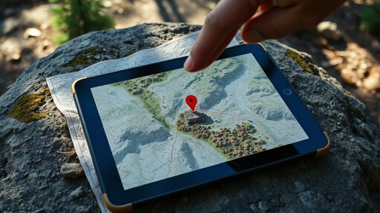
Navigation just got real-your smartphone or AR glasses can now overlay digital trails, waypoints, and elevation data directly onto your live camera view. The system uses visual depth to align virtual markers with real terrain, ensuring trails appear correctly on hills or valleys. Motion tracking keeps the display stable as you move, adjusting in real time to head orientation and location shifts. You see arrows floating mid-air at trail junctions or elevation numbers hovering over distant peaks. It works best in open areas with clear GPS and camera visibility. Dense forest or poor lighting reduces accuracy, since the tech relies on constant visual and positional input. Device battery life drops fast with AR running, especially on phones. AR mapping doesn’t replace traditional tools-it supplements them. You still need a backup compass and paper map when signals fail or visuals glitch.
AR Navigation Apps and Devices for the Wilderness
Your gear matters when AR navigation is on the line-only a few apps and devices deliver reliable performance in remote terrain. Current AR hardware limitations mean most smartphones and smart glasses struggle with GPS drift, weak processing, and poor display visibility in bright sunlight. Devices like the Garmin GPSMAP series paired with AR apps such as PeakVisor Pro handle topographic overlays better, but even they face battery dependency issues under prolonged use. You’ll get 4–6 hours of active AR navigation on a standard smartphone, less in cold conditions. Ruggedized smart glasses, like those from Vuzix, offer hands-free use but are heavy and dim in direct sun. Offline map support and low-power GPS modes help, but they don’t eliminate the need for spare batteries or solar chargers. Choose gear that balances durability, power efficiency, and real-world signal stability. Test it before you rely on it.
Tools You Need to Start AR Trail Navigation
A solid AR trail setup starts with a reliable GPS-enabled device that won’t quit when you need it most. You’ll want one with strong signal retention and offline map support-tested models like the Garmin GPSMAP 66i or Samsung Galaxy S23 with external GPS backup perform well in dense forest. Pair it with AR-compatible smart glasses or a ruggedized headset that supports AR display calibration so overlays align accurately with terrain. Misalignment risks navigation errors, especially on unmarked trails. Battery life management is critical-plan for at least 8–10 hours of continuous use. Carry spare batteries or a solar charger; many devices drain fast under heavy AR processing. Your phone’s screen brightness and GPS use directly impact longevity. Choose gear that balances weight, durability, and power efficiency. Test everything at home first-calibrate displays under different lighting and verify positional accuracy before heading into remote areas.
Creating Routes With AR Waypoints and Overlays
Waypoint accuracy starts with how you set it. Place virtual waypoints at distinct landmarks-like ridge junctions or river bends-for reliable alignment with the real world. Your device’s GPS and compass must be calibrated to reduce drift, especially in dense tree cover where signal loss affects precision. Use terrain highlighting to identify elevation changes and hazardous slopes in your route planning; it overlays gradient colors on your camera view, helping you pick safer, more efficient paths. AR route tools let you preview the entire trail with virtual waypoints as floating markers, but their usefulness depends on battery life and screen visibility in sunlight. Test your setup in daylight with full charge before relying on it. Combining terrain highlighting with well-placed virtual waypoints improves route clarity, but always confirm spacing matches actual walking distance-some systems overestimate by up to 10%.
When AR Fails: Staying Safe With Traditional Skills
Reliance on technology is a calculated risk when traversing remote terrain. Signal loss and battery drain can disable AR overlays without warning, leaving you disoriented. When that happens, traditional navigation skills keep you on track. A topographic map and compass don’t fail-no charging, no signal needed. They require practice, but proficiency means you can pinpoint your location using landmarks and terrain features. Carry a physical map as backup, ideally waterproof and marked with your planned route. Know how to read contour lines, use an altimeter, and take a bearing. Even GPS watches eventually die, but a compass works indefinitely. Pair minimal gear with practiced technique. Your safety doesn’t depend on AR-it depends on your ability to adapt when it fails. Master the basics, and you’re prepared when electronics can’t keep up.
Using AR Mindfully Without Losing Nature’s Connection
While AR can enhance your awareness of the terrain, using it too much might dull your attention to the actual environment around you. You risk developing digital dependency if you rely solely on overlays for navigation, missing subtle cues like animal tracks, wind shifts, or terrain features. Sensory immersion in nature-sounds, smells, textures-provides critical context no screen can replicate. Use AR in short bursts, then stow the device. Check your bearings every 10–15 minutes instead of continuously scanning. This balances tech assistance with real-world observation. Test AR use in mild settings before committing in remote areas. Devices last 4–6 hours on average; carry backup power only if weight isn’t critical. The goal isn’t to replace awareness but to supplement it. Stay present. Let natural cues guide you first, tech second.
On a final note
You’ll rely on AR overlays to follow trails in real time, but signals fade and batteries drain. Most apps use GPS and phone sensors, which work short-term but drain power fast-typically 4–6 hours on a full charge. AR supplements navigation; it doesn’t replace maps and compass. When the tech fails, your survival depends on skill, not software. Use AR mindfully, keep analog backups, and stay oriented by measurable terrain features.