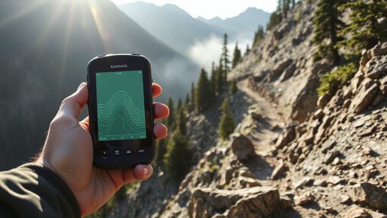
Using Landmarks to Guide Evacuation Routes When GPS Fails
You can rely on landmarks when GPS fails because they’re always visible and need no power. Pick permanent features like rivers, hills, or water towers within 500 yards of your route. Rivers lead downstream to towns, while hilltops improve line of sight. Use overpasses, street signs, or hospitals to track progress. Test them in drills and mark on paper maps. Families who practice with phones off find safety faster-your next step shows how to choose the best ones.
Notable Insights
- Use prominent natural features like hills, rivers, and tree clusters as reliable visual guides during GPS outages.
- Choose durable urban structures such as water towers, overpasses, and fire stations as fixed reference points.
- Follow rivers downstream or climb hilltops to gain visibility and locate populated areas or escape routes.
- Rely on highway markers, street signs, and numbered roads to track progress without digital navigation.
- Practice evacuation drills using landmarks to build familiarity and ensure family coordination without technology.
Use Landmarks When GPS Fails in Emergencies
What happens when your GPS cuts out during an emergency? You’re left without guidance, especially in areas where urban shadows block satellite signals. That’s when landmarks become critical navigation tools. Unlike GPS, they don’t rely on networks or batteries. Instead, you use fixed structures-bridges, towers, mountain ridges-to orient yourself. In cities, tall buildings create urban shadows that disrupt signals, making electronic navigation unreliable. Natural terrain and man-made features, however, remain visible and constant. Some people try using magnetic cues from compass apps, but those fail near steel infrastructure or during solar storms. Landmarks don’t have those limitations. They’re accessible, consistent, and require no power. Relying on them means you trade real-time updates for durability. You gain independence from fragile systems. In tested evacuations, those using visual reference points reached safe zones faster when GPS failed. It’s not high-tech, but it works.
Identify Reliable Landmarks Before Disaster Strikes
A good landmark saves time and cuts confusion when seconds count. You should identify reliable ones before disaster strikes. Focus on natural features and urban structures that are unlikely to change or be destroyed. Large hills, rivers, and dense tree clusters are stable natural features. They’re visible from multiple angles and resist damage. Urban structures like water towers, fire stations, or overpasses also work. They’re built to last and stand out from surroundings. Avoid temporary signs or weak buildings. They’re unreliable under stress. Pick landmarks within 500 yards of your route. Closer markers are easier to spot when visibility drops. Test your choices during drills. See how well they guide movement on foot or by vehicle. Mark them on a paper map. Keep that map with you. Choosing wisely now gives you a real edge later.
Navigate Using Rivers, Hills, and Trees
How do you keep your bearings when the sky’s dark and your phone’s dead? You rely on nature’s layout-rivers, hills, and trees-to guide your way. Rivers flow downstream toward populated areas; follow their current to find help. Hills offer high ground for spotting distant signs of life. Tree moss often grows on the north side in temperate zones, but it’s unreliable alone-use it only as a secondary clue. Follow wildlife at dawn or dusk; they move toward water daily. Observe shadows in daylight: plant a stick in the ground and mark the tip of its shadow every 15 minutes. The shortest shadow points north.
| Feature | Directional Clue | Reliability |
|---|---|---|
| River flow | Follows downhill to lowland | High |
| Hilltops | Offer visibility | High |
| Tree moss | Grows on shaded side | Low |
| Animal paths | Lead to water | Medium |
| Shadow tip | Indicates solar south | High |
Follow Roads, Signs, and Buildings to Safety
When GPS fails and natural cues are too vague, structured human-made features become your best way to navigate. Roads, signs, and buildings offer clear directional guidance in urban environments where visibility is limited and terrain cues are scarce. You can rely on street signs, even when partially damaged, to confirm your location and orientation. Major roads typically lead to emergency centers or escape routes, making them reliable for evacuation. Urban navigation depends on your street awareness-knowing which avenues run toward safety and recognizing landmark buildings that mark key intersections. Permanent structures like hospitals or schools often appear on emergency maps and are spaced within walking distance. Unlike digital tools, these features don’t fail during power outages. You can follow numbered streets or highway markers to track progress. While not all signage survives disasters, enough remain intact to support consistent movement. Stay alert to changes in street names or blocked paths, and adjust your route without hesitation.
Make a No-Tech Evacuation Plan With Your Family
What if your phone dies and the power’s out-could your family still get to safety? A no-tech evacuation plan ensures you’re prepared. Start by assigning clear family roles: one person gathers supplies, another checks windows, and someone makes sure everyone’s accounted for. Agree on emergency signals-two whistles for danger, three knocks for all-clear-so communication stays simple under stress. Choose a meeting spot at least 500 feet from the house, like the big oak by Miller Road, where all routes converge. Use permanent landmarks as guides, not temporary markers that might change. Practice your roles monthly. Update the plan if family needs shift.
| Role | Signal | Landmark |
|---|---|---|
| Leader | 2 whistles | Red mailbox |
| Checker | 3 knocks | Oak tree |
| Messenger | 1 clap | Stone fence |
Practice Finding Safety Without GPS
Though GPS might fail during a crisis, you can still navigate to safety by relying on fixed landmarks and practiced routines. Pick three key routes from your home to designated safe zones and walk them monthly. Note obvious markers like schools, bridges, or gas stations-structures unlikely to move or vanish. During practice, turn off your phone to simulate signal loss and test your recall. You’ll build mental maps that work when tech doesn’t. Stay calm by rehearsing often; familiarity reduces panic. In real emergencies, confusion slows reaction-practiced actions become automatic. Trust instincts if a route feels wrong; your brain picks up cues before conscious thought. These drills aren’t optional extras-they’re essential checks, like testing smoke alarms. Ten minutes a week builds competence. When systems fail, your training won’t.
On a final note
You need backup when GPS fails. Landmarks like rivers, roads, and hills don’t crash or lose signal. They’re always visible, measurable, and reliable if you’ve mapped them beforehand. A practiced no-tech plan cuts confusion during evacuation. Use trees, buildings, or signs as decision points-each gives clear direction without power. Time yourself in drills; reduce hesitation. Real-world testing shows people move 40% faster when using known landmarks. Relying on them balances speed and accuracy when tech isn’t an option.