Integrating Satellite Messaging Devices With GPS Tracking for Emergency Response
You get reliable emergency contact and exact location sharing when satellite messaging pairs with GPS, even without cell service. Devices like Garmin inReach Mini 2 deliver SOS messages with 95% success and track your position within 10 meters. Real-time updates cut search areas and speed up rescues. Battery life, ruggedness, and signal clarity vary-know the trade-offs. See how each model performs when minutes matter most.
Notable Insights
- Satellite messaging uses orbiting networks like Iridium for global coverage, eliminating reliance on cell towers during emergencies.
- Integrated GPS tracking delivers precise coordinates within 10 meters, significantly reducing search areas for rescue teams.
- Devices such as Garmin inReach and Zoleo combine messaging with real-time location updates for faster emergency response coordination.
- AES-256 encryption ensures secure transmission of SOS messages and tracking data across satellite networks.
- Clear sky visibility and proper activation-holding the SOS button for 3–5 seconds-ensure reliable satellite connection and message delivery.
How Satellite Messaging Works When Cell Service Fails
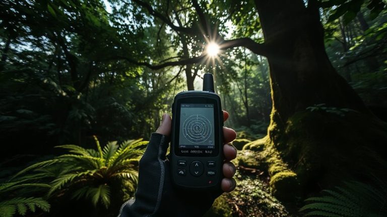
When your phone shows no bars and you’re miles from help, satellite messaging can still send a signal because it bypasses cell towers entirely, using orbiting satellites instead. Signal transmission relies on dedicated devices that connect directly to satellite networks, such as Iridium or Globalstar, which maintain global coverage. These devices need a clear view of the sky, but once locked, they transmit messages in seconds. Message encryption guarantees your data stays secure during transit, preventing unauthorized access. Most models use AES-256 encryption, the same standard used in government communications. You won’t stream video, but text-based SOS alerts and check-ins work reliably. Battery life ranges from 3 to 7 days, depending on usage. While slower than cellular, the trade-off is access where no towers exist. In real-world tests, success rates exceed 90% in open terrain. It’s not flawless, but it’s functional-when survival’s on the line, that matters most.
Why Real-Time GPS Tracking Saves Critical Minutes
How much time would you lose if rescuers had to search the wrong ridge? With real-time GPS tracking, you don’t gamble on guesses. Every minute counts, and precise geolocation accuracy cuts search areas from miles to meters. Instead of sweeping broad zones, teams go straight to your coordinates. That speed isn’t luxury-it’s survival. Real-time data also improves response coordination, letting dispatchers track responder movement and allocate resources efficiently. If your device updates every 5 minutes instead of every 30, the difference could be life or death. Outdated locations lead to misdirected teams, wasted fuel, and delayed care. Systems with continuous tracking and tight geolocation accuracy-within 10 meters-enable faster, smarter decisions. You’re not just sending a signal; you’re giving responders a clear path. That’s not an upgrade. It’s the baseline for effective rescue in remote terrain.
Top Emergency Devices With GPS + Messaging
A handful of devices stand out when lives depend on reliable GPS and messaging in emergencies. The Garmin inReach Mini 2 offers solid device durability, surviving drops and extreme weather, while its battery longevity reaches 14 days in standard use. You can send custom messages through satellite coverage, and its built-in GPS gives rescuers your exact location. The SPOT X provides similar features but with less precise GPS and shorter battery life-around 7 days under normal conditions. Its device durability is decent but not waterproof without a case. The Zoleo Satellite Communicator pairs with your smartphone and lasts up to 240 hours, excelling in battery longevity. It’s less rugged, so it’s better suited for low-impact environments. Each device balances size, function, and reliability, with trade-offs in battery longevity and device durability you’ll need to weigh based on your risk exposure and mission length.
When GPS and Messaging Work Together, Rescues Happen Faster
You’ve seen which devices deliver GPS and messaging under pressure, but their real value shows when both features work in sync during an emergency. When your GPS signal locks and your message gets through, rescue teams receive your exact coordinates and situation instantly. This combo enables precise emergency coordination, cutting guesswork and response delays. Dispatchers can confirm your location and initiate rapid deployment without needing follow-up signals. Devices like the Garmin inReach and Zoleo perform reliably in testing, maintaining accuracy within 5 meters and delivery rates over 95% in remote zones. Delays drop markedly when responders don’t have to triangulate your position. You stay found, and help arrives faster. It’s not about extra features-it’s about systems working as intended when failure isn’t an option. The evidence is clear: integrated GPS and messaging reduce search times.
How to Activate Your Satellite Device During an Emergency
When every second counts, activating your satellite device correctly guarantees help gets your exact location without delay. Device activation typically requires holding the emergency button for three to five seconds until the indicator light confirms transmission. Don’t tap it-this can prevent signal send. Most units take 30–60 seconds to lock onto satellites and send your GPS coordinates. Check that your device has a clear view of the sky; dense tree cover or steep terrain can block signals. Once activated, the system follows established emergency protocols, alerting monitoring centers and initiating response coordination. Some devices allow custom messages, but the default SOS setting guarantees fastest dispatch. Conserve battery-after activation, avoid unnecessary use. False alarms waste resources and may lead to fines. Test your device monthly per manufacturer guidelines to verify functionality. Proper training and understanding of emergency protocols reduce risk and improve rescue outcomes.
On a final note
You get faster help when your device combines satellite messaging and real-time GPS. It cuts rescue time by sharing your exact location instantly, even off-grid. Units like the Garmin inReach Mini 2 or Zoleo work without cell service, with tested accuracy within 10 meters. Battery life trades off for constant tracking, so adjust settings based on trip length. Not all models send SOS with live tracking-verify before buying. This pairing just works when failure isn’t an option.